And so began week two of this incredible adventure (pics and highlights below)
Remember - if you click on the photo you get a bigger jpg view of it.
Sept 18th: Drove from Kanab to Bryce Canyon National Park.
 Bryce is the land of hoodoos. I hiked to Yovimpa Pass for amazing views south across the Grand Canyon; viewed the grand ampitheater from a hoodoo ledge off Bryce Point; and then ate my picnic dinner while watched the sunset/moonrise at Fairyland Point.
Sept 19th: Woke up before the sun in Red Rock Canyon State Park located near Bryce and hopped on my mountain bike for a morning role up (and then down) the Thunder Mnt trail -- SUPER FUN.
 Loaded up and started out towards the north side of Escalante National Monument. The road (Hwy 12) takes one through an incredible landscape of mesas, red rock, farms, canyons, archeological sites, and very small towns. Reached Calf Creek by mid-day and headed up canyon for a swim.
Calf Creek is a spring fed tributary to the Escalante River. It hosts trout and an oasis-like valley floor that twists through high sandstone canyon walls. (can you see the animal in this photo?)
 The swimming hole destination was Lower Calf Creek Falls -- a 125 ft tall waterfall of cold refreshing serenity.
Sept 20: Saw small rain clouds moving fast across the plateau this morning so checked at the BLM office for a weather report before heading down Hole in the Rock Road (Escalante Nat Mon) to explore slot canyons of the north Escalante.
 Weather report was OK but road conditions from August flash floods limited my access to the slots that were more than 40 miles down the rutted gravel/sandy dirt road.
But I was not disappointed in the least by the slot canyons I could reach. Peekaboo, Spooky, and Coyote Gulch were like an adult playground to climb and squeeze through. Bliss day!


 The high cliffs & narrowness of Spooky made it almost impossible to get photos.
That night I found the "best" road-side campsite off the Burr Trail Rd where the fattening moon lit up the white sandstone cliffs that encircled me.
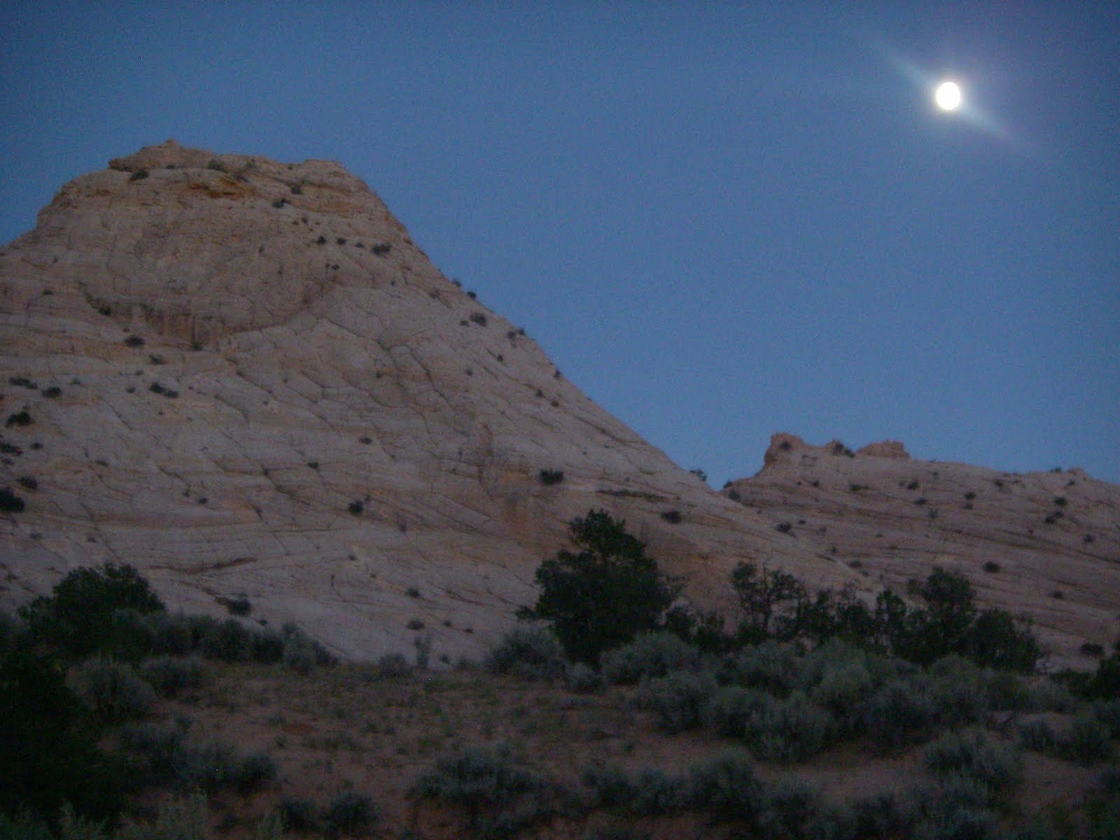
Sept 21: Sunrise hike/climb up the white cliffs; breakfast at Hells Backbone Grill (decadence) in Boulder; a weather check at the BLM office; then off down the Burr Trail Rd for more canyon exploration.
 NOTE: The Burr Trail Road has the most insane road-side landscape views I have ever witnessed.
 Did a 15-16 mile day of hiking the Upper Muley Twist just off the Burr Trail located at the southern most end of the Capital Reef National Park.

 Beyond the beauty of the canyon itself (arches, cliffs, slot canyons, rock features, etc) a short trail east offered a view of one of the most amazing geologic fault exposures I have ever seen -- the Waterpocket Fold. Made me giddy to stand on the sheer cliff edge of it.
Left the trailhead just before dark and headed south towards the north rim of the Colorado River. Found a closed BLM road to camp on located on a high plateau over Lake F(P)owell -- as thunderstorms were suppose to move in over night.

Sept 22: Sunny morning. Crossed Lake F(P)owell via car ferry at a shore-town called Bull Frog.
 Once on the other side of the lake I was en route to Natural Bridges Nat Park. While driving I spotted an unmarked Ancient Pueblo ruin in the cliffs just a short walk through a dry drainage and up the cliff-side.
 Castle ruins
Heavy rains with crashing thunder finally hit just before I arrived at Natural Bridges (10:30am). The soggy touring group of motorcyclist in the visitor's center didn't look as excited as I was about the rain. To me -- rain meant that I would finally see these water-shaped landscapes wet instead of dry (very exciting to a geomorphologist).
 It also meant that I couldn't walk the river trail through Natural Bridges (flash flood issues) -- instead I walked each trail from the road down into the canyon to each bridge. The walls of the canyon dripped and sang with the movement of water across them but the rains did not make the river's below swell. Small pools and connecting rivuletes formed. The bridges were breathtaking. Talk about "meander scars."
 The weather broke (or so I thought) as I came up from the last bridge hike. There I bumped into a familiar face (RA-Scott C) from the road and we decided to try our luck doing a short hike to see some Ancestral Pueblo cliff dwellings about 10 miles out of the park.
On top of the white sandstone cliffs near the ruins is where the thunderstorms really hit. In minutes, waterfalls formed everywhere and I was standing in the middle of true Hortonian Overland flow. I could not have been happier. When my hair stood on end (yes even when wet) we quickly moved downslope to reduce the chance of being a static conductor for a lightning strike. In minutes a few inches of water turned into a few feet of water -- a true flash flood. And I was loving it! Then, just 15-20 minutes after the rain stopped, the gullies, waterfalls, and washes went from gushing torrents to quiet trickles to wet sand.


I arrived at the home of my dear dear friend RA-Chris M and family at 8pm where hugs and warm soup awaited me. BLISS DAY!
Sept 23: Had a shower the night before and slept well. Chris took me up to part of the freshly snow dusted Rocky Mnts in SW Colorado known as the San Juans.


Windy Pass, CO.
 * all photos by Pollyanna Lind