Sunday, October 3, 2010

Southwest Adventure -- WEEK 3

Week Three ......... and it felt like it was only just beginning!
I had made it to my eastern-most destination of Cortez/Mancos, Colorado.
Click on the photos for a larger image view

Sept 24: MESA VERDE! I had wanted to stand amongst these Ancient Pueblo cliff dwellings since I was 12 years old. This was the day! Chris and I woke early to meet up with friends and head into the park to explore ruins and petroglyphs. No words (nor photos) can really describe it. The size and number of cliff dwellings that are spread out amongst the high sandstone cliffs was impressive (to say the least). VERY COOL.We were back to town by dusk so that Chris could make the street performance gig with the band (Vixen) that she and her brother Mike play in. the music was grand and it kicked off the annual hot air balloon festival -- which led into late night merriment and silliness for all.

Sept 25: Apple picking in the morning, garden lounging, and talking/laughing with friends and family this day. FYI, I adore the Rasmussen clan and have adopted you all.In the evening was another "Vixen" performance at the old opera house in Mancos. We, of course, all attended.
Sept 26th:
After a grand family breakfast and packing up I started the first leg of my trek westward. First stop -- Newspaper Rock and Canyon Lands National Park, Needles area.
Newspaper Rock petroglyphs.

Ran into co-traveler Scott C again just before entering the park.

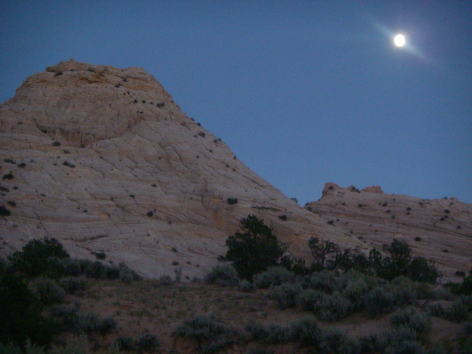
Afternoon hike across the red rock to Squaw Canyon where we found a high point amongst the many misshapen sandstone pinnacles and mesas. The objective -- finding a suitable location to view the sunset. But the stars and moon that joined us on the night walk back across the desert stole the show.

Sept 27th: Canyonlands (day 2) Hiked into Peekaboo Spring down Salt Creek. An entire day alone in the desert ..... ahhhhhh. Insane landscapes; pictographs; cliff dwellings; coyote and bear tracks in the sand next to mine; quick sand; and precious vast solitude.Made it to Moab before dark and found a campsite along the Colorado River off Rd 128.

Sept 28th: Stopped by a truly fantastic bookstore in Moab to say hello to a friend of a friend. If you, or anyone you know, is ever in Moab you MUST stop at Arches Book Co and Back of Beyond Books. It is the best! They are locally owned and have everything we book appreciators could ask for from local/regional geology and guide books to best sellers (new and used). And the owners are great people.Since in Moab -- I unloaded the mountain bike to ride the Slick Rock trail. I was surprised at how such a short trail (only 12 miles) could literally kick my ass (rated physically and technically difficult). I had so much fun I can't even describe it. Sadly, I did not have my camera with me ....... pooh, no pics (see this link for info/images).

Another campsite on the Colorado River for the night, but this time I was off Rd 279 -- near petroglyphs and trial heads of interest. Had an owl rest above my tent in the moonlight that night.

Sept 29th: Exploration of petroglyphs and a hike up to Bow Tie and Corona Arch to start the day.

I was very impressed with these arches -- both in size, aesthetics, and the landscape they were located in. And, there were only a few people at the site.

In search of more arches ...... I headed into Arches National Park. This is a very popular park with quite a bit of traffic. Lucky for me -- when I hiked into Delicate Arch there was only a handful of people at the site.

The other features of the park were impressive but the crowds were more than I wanted to deal with.
It was time for me to start my long drive home.

Reached Scofield, UT State Park by sunset. The smoke in the sky from "controlled burns" made for a colorful dusk over the reservoir. The campsites were lame, but there were hot showers. This was a bonus after having the muddy Colorado River as my only "rinse 0ff" option for several days.
Sept 30: The long ride home to western Oregon. Hit the road at 5:30 am -- made it through Salt Lake City by 7am. Once on Hwy 80 heading west traffic disappeared and I was on the move.

Stop to make myself breakfast just outside of the Bonneville Speedway salt flats. Dry, flat, crusty, and beautiful -- a perfect breakfast picnic site.

The towns slipped by as the road miles hummed along. I knew I was truly back in Oregon when I saw the multi-colored bird and plant-rich marshes of Warner Valley and the clean, cold tumbling of Warner River along the southern border of the state. Made it home at 9 pm (PST). That was 16.5 hours on the road.

Today: I am immersed in the lush green beauty of the Pacific Northwest but the warmth and openness of the SW is forever in my bones and skin. There is still soft red dust to wash off of gear and clothing. There are books and maps to sort. There are photos to organize. There are Road Angels to thank. There are notes to transcribe into journals. Then, there is the next trip into the Southwest to plan.
I am filled with the many gifts of gratitude that created this trip. I feel strong, open, alive, clear, and filled with inspiration. It is a privileged place to be -- and I will forever appreciate this gift.

It is through the exploration and adventures of life that we discover not only the vast beauty of this world's landscapes, but ourself within them.

all photos by P. Lind

Saturday, October 2, 2010

Southwest Adventure -- WEEK 2

In Kanab, UT I was treated like a rock star by my new dear friend and amazing hostess RA-Lis F. (RA = road angel). .... THANKS again LIS!!! you are the best! I hit the road having been well fed, well rested, and with all my laundry clean.
And so began week two of this incredible adventure (pics and highlights below)
Remember - if you click on the photo you get a bigger jpg view of it.
Sept 18th: Drove from Kanab to Bryce Canyon National Park.Bryce is the land of hoodoos. I hiked to Yovimpa Pass for amazing views south across the Grand Canyon; viewed the grand ampitheater from a hoodoo ledge off Bryce Point; and then ate my picnic dinner while watched the sunset/moonrise at Fairyland Point.

Sept 19th: Woke up before the sun in Red Rock Canyon State Park located near Bryce and hopped on my mountain bike for a morning role up (and then down) the Thunder Mnt trail -- SUPER FUN.
Loaded up and started out towards the north side of Escalante National Monument. The road (Hwy 12) takes one through an incredible landscape of mesas, red rock, farms, canyons, archeological sites, and very small towns. Reached Calf Creek by mid-day and headed up canyon for a swim.

Calf Creek is a spring fed tributary to the Escalante River. It hosts trout and an oasis-like valley floor that twists through high sandstone canyon walls. (can you see the animal in this photo?)
The swimming hole destination was Lower Calf Creek Falls -- a 125 ft tall waterfall of cold refreshing serenity.

Sept 20: Saw small rain clouds moving fast across the plateau this morning so checked at the BLM office for a weather report before heading down Hole in the Rock Road (Escalante Nat Mon) to explore slot canyons of the north Escalante.
Weather report was OK but road conditions from August flash floods limited my access to the slots that were more than 40 miles down the rutted gravel/sandy dirt road.
But I was not disappointed in the least by the slot canyons I could reach. Peekaboo, Spooky, and Coyote Gulch were like an adult playground to climb and squeeze through. Bliss day!
The high cliffs & narrowness of Spooky made it almost impossible to get photos.
That night I found the "best" road-side campsite off the Burr Trail Rd where the fattening moon lit up the white sandstone cliffs that encircled me.
Sept 21: Sunrise hike/climb up the white cliffs; breakfast at Hells Backbone Grill (decadence) in Boulder; a weather check at the BLM office; then off down the Burr Trail Rd for more canyon exploration.NOTE: The Burr Trail Road has the most insane road-side landscape views I have ever witnessed.Did a 15-16 mile day of hiking the Upper Muley Twist just off the Burr Trail located at the southern most end of the Capital Reef National Park.
Beyond the beauty of the canyon itself (arches, cliffs, slot canyons, rock features, etc) a short trail east offered a view of one of the most amazing geologic fault exposures I have ever seen -- the Waterpocket Fold. Made me giddy to stand on the sheer cliff edge of it.
Left the trailhead just before dark and headed south towards the north rim of the Colorado River. Found a closed BLM road to camp on located on a high plateau over Lake F(P)owell -- as thunderstorms were suppose to move in over night.
Sept 22: Sunny morning. Crossed Lake F(P)owell via car ferry at a shore-town called Bull Frog. Once on the other side of the lake I was en route to Natural Bridges Nat Park. While driving I spotted an unmarked Ancient Pueblo ruin in the cliffs just a short walk through a dry drainage and up the cliff-side.Castle ruins

Heavy rains with crashing thunder finally hit just before I arrived at Natural Bridges (10:30am). The soggy touring group of motorcyclist in the visitor's center didn't look as excited as I was about the rain. To me -- rain meant that I would finally see these water-shaped landscapes wet instead of dry (very exciting to a geomorphologist).
It also meant that I couldn't walk the river trail through Natural Bridges (flash flood issues) -- instead I walked each trail from the road down into the canyon to each bridge. The walls of the canyon dripped and sang with the movement of water across them but the rains did not make the river's below swell. Small pools and connecting rivuletes formed. The bridges were breathtaking. Talk about "meander scars."The weather broke (or so I thought) as I came up from the last bridge hike. There I bumped into a familiar face (RA-Scott C) from the road and we decided to try our luck doing a short hike to see some Ancestral Pueblo cliff dwellings about 10 miles out of the park.
On top of the white sandstone cliffs near the ruins is where the thunderstorms really hit. In minutes, waterfalls formed everywhere and I was standing in the middle of true Hortonian Overland flow. I could not have been happier. When my hair stood on end (yes even when wet) we quickly moved downslope to reduce the chance of being a static conductor for a lightning strike. In minutes a few inches of water turned into a few feet of water -- a true flash flood. And I was loving it! Then, just 15-20 minutes after the rain stopped, the gullies, waterfalls, and washes went from gushing torrents to quiet trickles to wet sand.

I arrived at the home of my dear dear friend RA-Chris M and family at 8pm where hugs and warm soup awaited me. BLISS DAY!

Sept 23: Had a shower the night before and slept well. Chris took me up to part of the freshly snow dusted Rocky Mnts in SW Colorado known as the San Juans.

Windy Pass, CO.
* all photos by Pollyanna Lind

Friday, September 17, 2010

Southwest Adventure -- WEEK 1


On the ROAD -- working my way across the geography of the SW (USA).
WOw .... first time to have usable internet in over a week ..... (a sign that my trip to the SW is working out fabulously). Currently sitting at a friend's kitchen table in Kanab, UT (just 5 miles north of the AZ border).

It has been an incredible adventure thus far. Each day brings new landscapes. I can literally feel my soul and mind expanding. The gratitude I am experiencing on a daily basis for this birthday gift trip/adventure is overwhelming (in a grand way). THANK YOU ALL SO MUCH for helping make this possible! -- best 40th b-day gift EVER.

I know that everyone wants pictures instead of paragraphs of bad waxing poetry. So, here you go. A few quick snapshots of highlights with subtitles to give you a peek into the last 9 days.

Steve joined me for the first 4.5 days (AWESOME!!). By day two we had made it to the east side of Yosemite via Mono Lake and Tioga Pass. (by the way .... Tioga Pass is the coolest road I have ever been on)

Morning in Yosemite National Park (9/10/10)

After a day and morning of hiking in Yosemite (chased out by the weekend crowds), we headed south to the east side of Kings Canyon National Park to hike into the John Muir Wilderness on the NE border of the park.

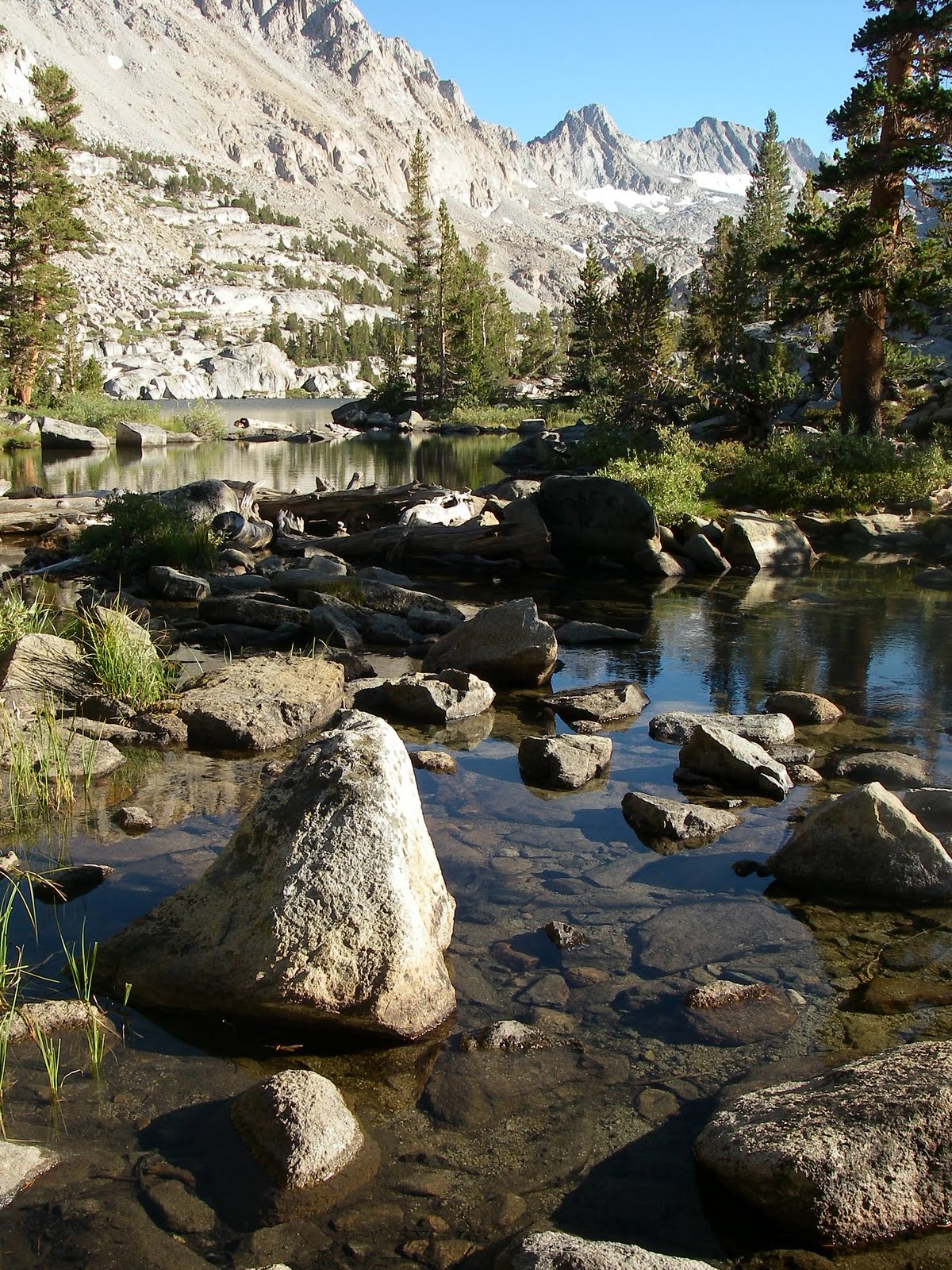
Blue Lake basin (~ 11,000 ft) - glacially scoured lake filled basin. So beautiful that tears filled my eyes. (9/11/10)

Then a drive through Death Valley National Park (9/12/10)


At the floor of the valley Steve and I hopped out to throw the disc (frisbee) on the sand. ~95F at 9:30 am. Good fun!


Steve flew out of Vegas back to Eugene at 6am on Monday (9/13) and I headed solo -- into the desserts of Nevada.

Valley of Fire (NV state park) -- petroglyphs; red rocks, white rocks, rainbow rocks; warm sand; and a hint of water. (9/13/10)

So enamored with the red-rocks at Valley of Fire, I arrived late at night to Snow Canyon Park, UT. But awoke the next morning to find myself in another set of lovely red rock mountains


ON to ZION! and to me being blown away by the grandeur of its landscape. "Scale" holds a whole other meaning in this park.

Angel's Landing ...... Zion (9/14/10)


The Virgin River winding it's way through The Narrows ..... Zion (9/15/10)


In south central Utah -- I did not get one of the 10 lottery permits offered per day to hike into the "The Wave" (something I will have to return for someday). Instead I opted to hike Buckskin Gulch in the Vermillion Cliffs wilderness area. Not disappointed in the LEAST.

Buckskin Gulch = Slot canyon insanity! (9/16/10)


Camped off a BLM road near the Buckskin trail head; did some early morning hiking in the area and then headed over to the Rim Rocks of Escalante National Monument. (9/17/10)

They call these crazy hoodoos "Toad Stools" --

NOTE: I have gotten to walking barefoot in the thick sandy washes. It is literally the softest sand I have ever felt between my toes .... and so ancient. yehh...do have to be careful of the prickly desert plants and occasional tarantula.

ALL photos by - Pollyanna Lind

Wednesday, September 8, 2010

40th year adventure

Sept 8, 2010 --> My adventure to the southwest has official begun!

As a geomorphologist and a lover of landscapes I am thrilled to have started off on this, my first exploration of the great SouthWest. I have the vehicle loaded, maps and books in hand, and am spending the first night of this adventure at The Hill. Looking forward to what I might find and who I may become from the experience of it all.

YYYYEEEEEEHAAAAAAA!!